
Can You Hike In the Myrtle Beach Area?
One of our favorite activities in the Carolinas is hiking, and surprisingly, Myrtle Beach does offer some great trails. In comparison, Myrtle Beach is renowned for its 60 miles of beaches, endless golf courses, a bustling boardwalk, and lively entertainment. The area offers more than sandy shores. Numerous hiking trails showcasing South Carolina’s diverse landscapes are nestled within and around our coastal city. Whether you’re a seasoned hiker or just looking for a peaceful walk in nature, Myrtle Beach has something for everyone.

Why Go Hiking Near Myrtle Beach?
- Diverse Scenery: From maritime forests to coastal wetlands, the hiking trails around Myrtle Beach offer a variety of scenic experiences.
- Wildlife Watching: These trails are perfect for spotting local wildlife, including birds, deer, and even alligators.
- Accessibility: Many trails are located close to the city, making them easy to reach for a quick getaway.
- Year-Round Hiking: Hiking can be enjoyed almost year-round thanks to the mild climate.
What Are The Top Hiking Trails Near Myrtle Beach?
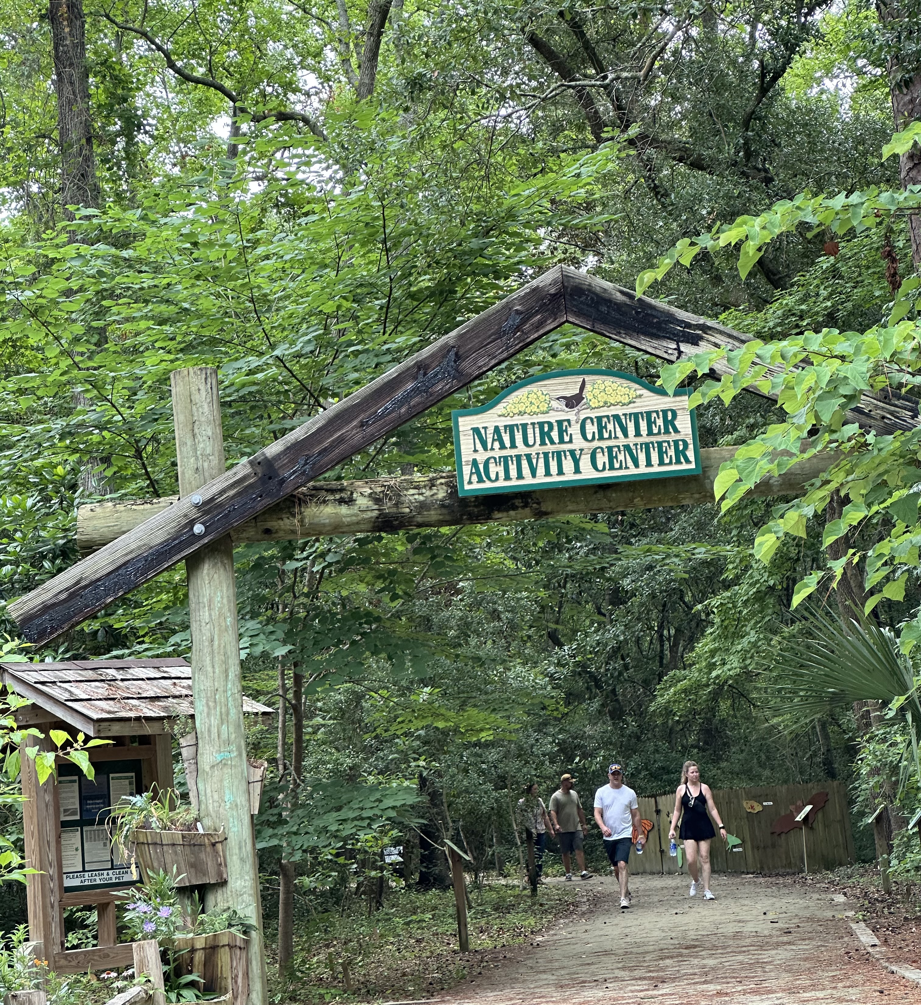
1. Myrtle Beach State Park
Location: 4401 S Kings Hwy, Myrtle Beach, SC 29575
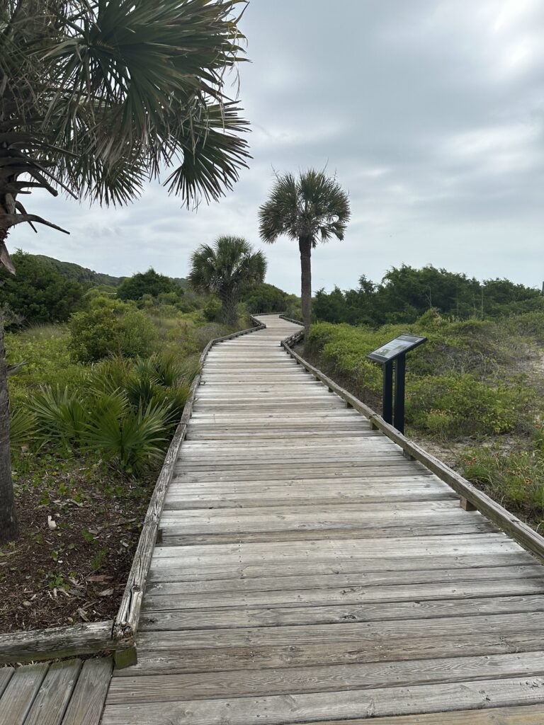
Starting from the parking area near the Nature and Activity Centers, cross the road to embark on the Sculptured Oak Trail for an easy walk through the woodlands that once dominated the Grand Strand. This trail takes you through a forest filled with oaks, wax myrtles, hollies, poplars, and magnolias, providing a habitat for various species of birds, reptiles, and amphibians.
You can continue straight to visit an overlook by a pond, which depends on rainfall or turn left towards the beach. After a short distance, you’ll reach a fork where the Yaupon Trail branches off to the right. Both the Sculptured Oak and Yaupon trails lead to the beach, accessible via boardwalks. For a longer hike, you can follow one trail to the beach, cross a parking area, and return on the other trail. Check out the Myrtle Beach State Park trail maps here.
- Sculptured Oak Nature Trail
- Length: 0.5 miles
- Difficulty: Easy
- Highlights: This short loop trail is perfect for families and offers a serene walk through the maritime forest, with informative signs about local flora and fauna.
- Yaupon Trail
- Length: 0.4 mile
- Difficulty: Easy
- Highlights: This trail provides a pleasant stroll with views of the ocean and access to picnic areas and the fishing pier.
2. Huntington Beach State Park
Location: 16148 Ocean Hwy, Murrells Inlet, SC 29576
- Sandpiper Pond Nature Trail
- Length: 2 miles (one way)
- Difficulty: Easy to moderate
- Highlights: This trail offers views of Sandpiper Pond and the opportunity to spot a variety of bird species. It also leads to the beach for a refreshing end to your hike.
This easy 2-mile out-and-back trail winds through a maritime forest of ancient dunes adorned with oaks, pines, and cedars. Along the way, the Maxwell Observation Deck provides excellent viewing opportunities for a wide array of wading birds and alligators, ducks in the winter, and shorebirds during migrations.
For a longer hike, extend the trip to 2.5 miles round trip and continue north on the beach to the jetty. This jetty, one of a pair that stabilizes Murrells Inlet, creates a rocky coastline where none would naturally exist. Visitors can walk out across the ocean to observe a variety of rare seabirds and sea ducks in the winter, swimming juvenile sea turtles during the summer, and mink and dolphins year-round.
KERRIGAN NATURE TRAIL
- Length: 0.3 miles
- Difficulty: Easy
- Highlights: Enjoy an easy 0.2-mile walk from the parking area to an observation deck overlooking Mullet Pond, where you can spot shorebirds and wading birds. For a longer hike, explore the historic driveway of Atalaya Castle, offering views of Mallard Pond, nesting anhingas, wood storks, and even alligators.
From the parking area, enjoy an easy 0.2-mile walk to an observation deck overlooking the brackish water impoundment of Mullet Pond. Here, you might spot a variety of shorebirds and wading birds. For a longer hike, this trail intersects with the historic driveway of Atalaya Castle. Turn right to view the causeway that separates the freshwater Mallard Pond from Mullet Pond. Alternatively, turn left to return to the parking lot via the park roads.
During the spring and summer, you can expect excellent views of nesting anhingas, green and tricolor herons, and common gallinules. Additionally, you might see wood storks, roseate spoonbills, and swallow-tailed kites. In the winter, ducks are prominent. Other wildlife you may encounter include alligators, turtles, bullfrogs, and deer.
- Atalaya Castle Trail
- Length: 1.5 miles
- Difficulty: Easy
- Highlights: A unique trail that takes you around the historic Atalaya Castle, offering a glimpse into the area’s cultural history.
Learn more about Huntington Beach State Park Trails.
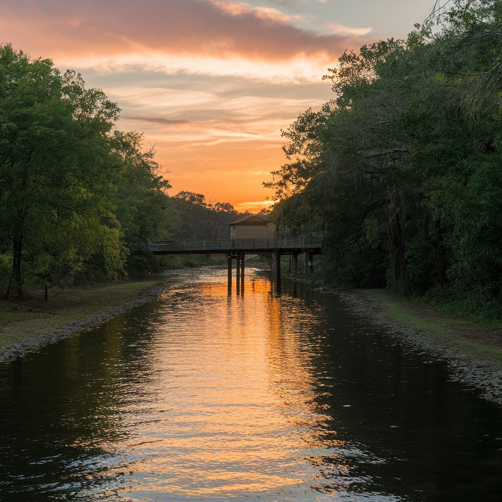
3. Conway Riverwalk
Location: 2nd Ave, Conway, SC 29526
- Conway Riverwalk Trail
- Length: 1.5 miles
- Difficulty: Easy – Boardwalk Paved
- Highlights: This picturesque trail along the Waccamaw River is perfect for a leisurely walk. Enjoy the charming views of the river, local wildlife, and the historic downtown Conway.
Conway’s oldest thoroughfare is the beautiful, deep, black waters of the Waccamaw River. Along the riverfront, you can enjoy a stroll on the Riverwalk or visit Riverfront Park at the Conway Marina.
4. Lewis Ocean Bay Heritage Preserve
Location: Huggins Rd, Conway, SC 29526
- Main Trail
- Length: 6 miles (out and back)
- Difficulty: Moderate
- Highlights: This Preserve is known for its unique Carolina bays and diverse ecosystems. The trail offers a peaceful retreat with opportunities to see rare plants and wildlife.
The Lewis Ocean Bay Heritage Preserve, located northwest of Myrtle Beach, boasts a fascinating natural history. During World War II, parts of the Preserve served as an aerial gunnery range for the U.S. Army Air Corps, and remnants of bombing and machine gun targets, along with the foundations of an army observation post, can still be found. Today, the Preserve is renowned for the mysterious Carolina bays—natural, elliptical-shaped depressions unique to northeastern South Carolina and southeastern North Carolina.
While the exact formation of the Carolina Bays remains uncertain, numerous theories exist. The Lewis Ocean Bay Heritage Preserve, spanning 9,393 acres of pristine Carolina woodlands, contains twenty-three undisturbed Carolina bays. These bays support a variety of vegetation, including wild orchids, mulberry bushes, wax myrtle bushes, the rare pitcher plant, and one of the world’s largest concentrations of Venus flytraps. The area is also home to Southern black bears, bald eagles, and the rare, protected red-cockaded woodpecker.
Recognized by the Audubon Society as an “important bird area” in South Carolina, the Preserve is owned and maintained by the state’s Department of Natural Resources. While it is open to the public, activities are strictly limited to preserve its natural state.
5. Waccamaw National Wildlife Refuge
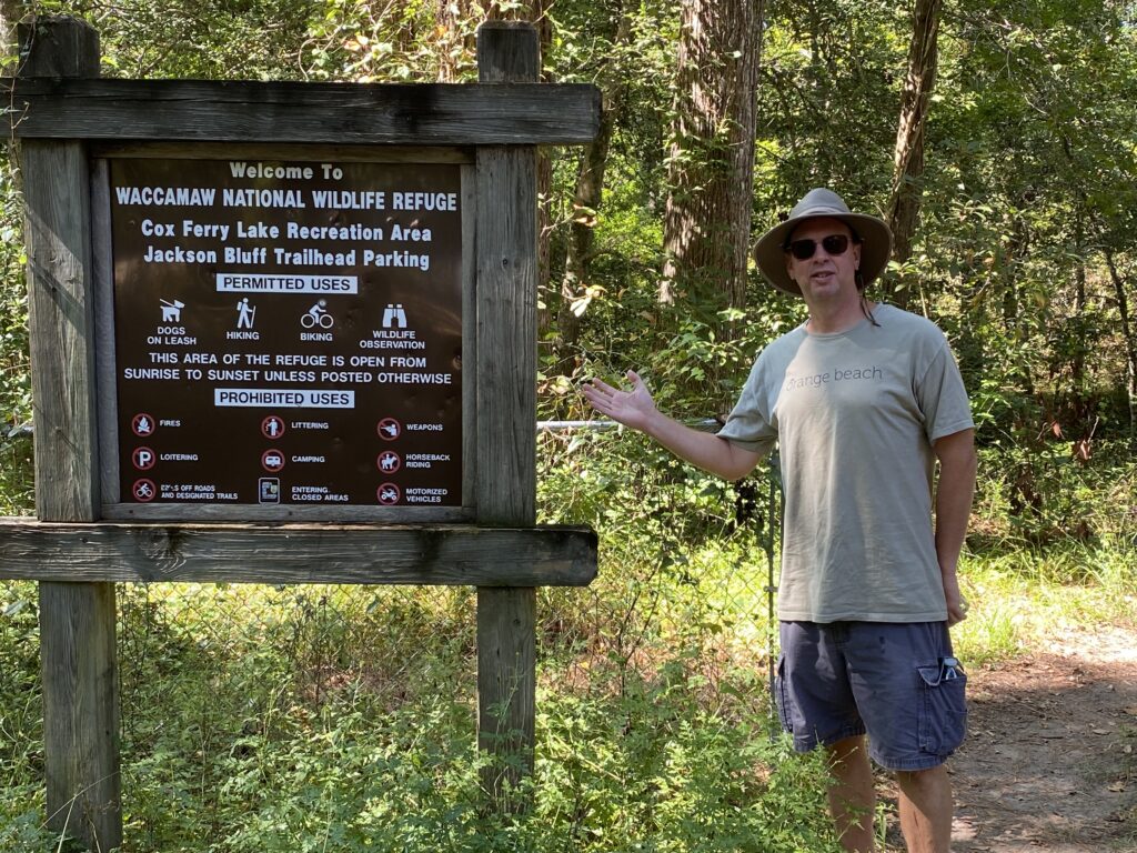
Location: 21424 North Fraser Street, Georgetown, SC 29440
- Cox Ferry Lake Recreation Area Trail
- Length: 2.3 miles
- Difficulty: Easy to moderate
- Highlights: A beautiful trail through wetlands and forests, perfect for bird watching and enjoying the tranquility of nature.
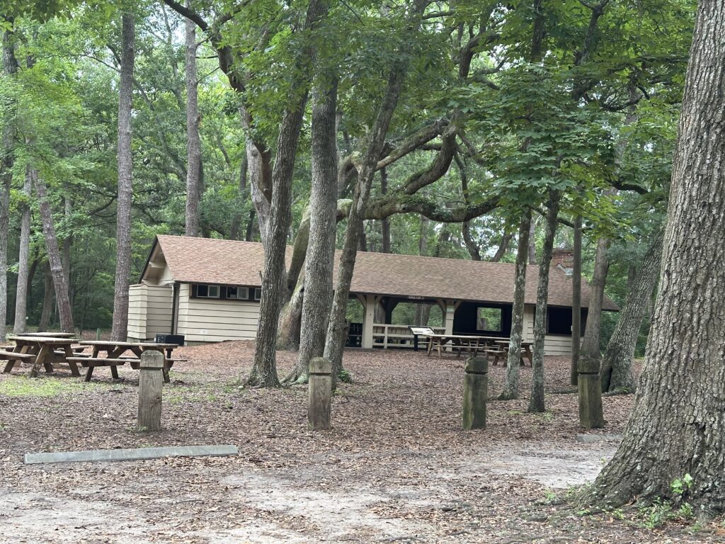
The Cox Ferry Lake Recreation Area, located on Gary Lake Boulevard and accessible from Jackson Bluff Road in Conway, South Carolina, spans 325 acres. It features three miles of interpretive nature trails, a mountain biking trail, a boardwalk, kiosks, and a weather shelter with picnic tables. The trails, accessible from both parking areas, lead visitors through diverse habitats and are open year-round for hiking, biking, environmental education, and nature photography.
Tips for Hiking Near Myrtle Beach
- Stay Hydrated: Always carry enough water, especially during the hot summer months. The high humidity in our area makes it harder for our bodies to cool, which can lead to heat exhaustion and heat stroke.
- Wear Appropriate Gear: Choose comfortable hiking shoes suitable for the trail’s terrain. Even if it has not rained for a few days, wet or flooded areas are not uncommon in the Lowcountry. A hat is a basic requirement. Utilize sunscreen for uncovered areas.
- Check Weather Conditions: Be aware of the weather forecast to avoid hiking in extreme heat or thunderstorms. The weather close to the ocean can change quickly, so stay vigilant.
- Bring Bug Spray: The coastal areas can have a lot of mosquitoes and other insects, so come prepared. Some say the state bird should be changed to the mosquito!
- Respect Wildlife: Observe animals from a distance and avoid feeding them. While it is rare to encounter dangerous animals on our trails, black bears and snakes are in the area.
Exploring the hiking trails near Myrtle Beach is a fantastic way to connect with nature and experience the diverse landscapes of South Carolina. From easy, family-friendly walks to more challenging adventures, there’s a trail for every level of hiker. Of course, hiking the beach is also a great way to get your steps in. Check out the best beach access points in Myrtle Beach Here.
Beyond The Beach: Discover Some of The Best Trails in South Carolina
The trails featured on this website are sponsored or managed by various agencies and departments. Not all were funded through the South Carolina Trails program. Trail descriptions and maps are based on information from trail owners, research of trail publications and websites, and user input. Typically, the first sentence of each description provides a brief overview, including difficulty, terrain, and trail surface, to help you decide if it’s the right trail for you. While the maps are created using GPS data, changes in weather or by the trail owner may cause some discrepancies.
Dennis Stemmle is a bestselling author, entrepreneur, and lecturer at Coastal Carolina University. He writes about travel, college success, and entrepreneurship.